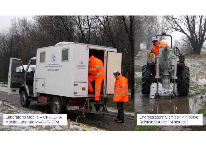
The parks of the metropolitan areas constitute a "window" through which it is possible to explore the subsoil. An intersesting characteristic of the metropolitan parks is that they have experienced a generally low anthropic interaction in the historical times. Therefore the subsoil below their surface preserves the geological and environmental features which are the consequence of the processes occurred in that areas along the time.
The geologic-physical characterization of the subsoil of the metropolitan areas is one of the main topics in building up the geological sheets of the CARG (Geologic Regional Cartography 1: 50,000 of the Italian territory ) Project. Such researches in fact meet some difficulties in finding the geologic information that mainly derived from boreholes and excavations, generally of small depths and poor quality, which were executed for civil and/or water resource targets.
This characterization assumes particular importance in the metropolitan areas also in the light of their urban and territorial use, like the construction of civil infrastructures and underground transport that reach evergrowing depths, the use of the resources of the subsoil, mainly the water, and the definition of the areas of urban development.
In such "windows" the application of geophysical prospecting methods is possible and allows the reconstruction of the geologic structures of the subsoil, as it has been demonstrated by the seismic experiment in the park of Milan called "Bosco in città".
The seismic prospecting is based on the surface recording, along sensor arrays, of signals that are produced by waves generated at the surface with explosive sources or drop masses. These waves, propagating through the subsoil, turn on to the surface because of refraction/reflection processes at the various discontinuities. The processing of the refracted and reflected phasesl recorded by the sensor arrays allows us to obtain seismic images of the subsoil which in turn can be interpreted in geological terms.
The goals of the seismic experiment in the "Bosco in Città" park, carried out by the Istitut for the Dynamics of the Environmental Processes (section of Milan) of the Italian National Research Council to support the CARG project geological Sheet 118 Milan, were: i) to check the logistic feasibility, reducing the environmental impact of the prospecting and ii) to define the the optimal experimental parameters.
Against any expectation, the seismic prospecting not only confirmed the logistic-experimental feasibility, due to the use of Minipulse, a drop mass source with low environmental impact (fig.1), but also evidenced the possibility of exploring the subsoil up to 1000 m depth, with small experimental geometries (arrays of 250 m). The two-dimensional image of the two way travel times (fig. 2) supplies information on seismic-geologic stratigraphy, with a vertical resolution ranging between about 5 and 15 m passing from the surface to the maximum imaged depth of about 1000 m, from the Holocene until the Medium Upper Pliocene (2,5-3 million years ago). Furthermore it allows us to correlate stratigraphic data of the available boreholes and to characterize and correlate the different water table levels existing in the Milan area.
Vedi anche:
Immagini:


